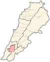
Toul, Nabatieh
Appearance
Toul
تول | |
|---|---|
Municipality | |
| Coordinates: 33°23′11″N 35°27′01″E / 33.38639°N 35.45028°E | |
| Country | |
| Governorate | Nabatieh Governorate |
| District | Nabatieh District |
| Time zone | UTC+2 (EET) |
| • Summer (DST) | UTC+3 (EEST) |
Toul (Arabic: تول) is a municipality in the Nabatieh District in Lebanon.
History
[edit]In 1875, Victor Guérin noted on his travels in the region: "on my right, to the north, on a hill from which a valley separates me, the little village of Toul. An oualy is dedicated to Neby Toul."[1]
Demographics
[edit]In 2014, Muslims made up 50% and Christians made up 50% of registered voters in Toul. 46.43% of the voters were Shiite Muslims and 46.43% were Maronite Catholics.[2]
References
[edit]- ^ Guérin, 1880, p. 526
- ^ "التوزيع حسب المذاهب للناخبين/ناخبات في بلدة تول، قضاء النبطية محافظة النبطية في لبنان". إعْرَفْ لبنان.
Bibliography
[edit]- Guérin, V. (1880). Description Géographique Historique et Archéologique de la Palestine (in French). Vol. 3: Galilee, pt. 2. Paris: L'Imprimerie Nationale.


