
File:China’s Critical Sea Lines of Communication.png
Size of this preview: 730 × 599 pixels. Other resolutions: 292 × 240 pixels | 585 × 480 pixels | 935 × 768 pixels | 1,046 × 859 pixels.
Original file (1,046 × 859 pixels, file size: 292 KB, MIME type: image/png)
| This is a file from the Wikimedia Commons. Information from its description page there is shown below. Commons is a freely licensed media file repository. You can help. |
| Description |
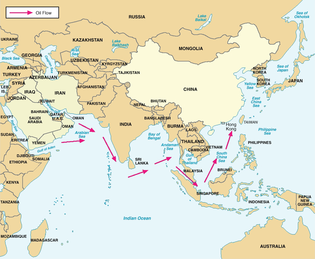
Figure 8. China’s Critical Sea Lines of Communication. Note: In 2004, over 80 percent of Chinese crude oil imports transited the Straits of Malacca, with less than 2 percent transiting the Straits of Lombok. Deutsch: Chinas wichtigste Ölversorgungswege auf See |
|||
| Date | 05/23/06 | |||
| Source | Image:China Report 2006.pdf; China Report 2006 [1] (PDF, 58 S., 1,42 MB) | |||
| Author | DoD | |||
| Permission (Reusing this file) |
|

File history
Click on a date/time to view the file as it appeared at that time.
| Date/Time | Thumbnail | Dimensions | User | Comment | |
|---|---|---|---|---|---|
| current | 14:17, 8 March 2018 | | 1,046 × 859 (292 KB) | Ras67 | new extracted and cropped from PDF |
| 22:28, 20 February 2016 |  | 1,045 × 735 (220 KB) | Mahahahaneapneap | Cropped | |
| 08:42, 26 May 2006 |  | 1,072 × 778 (311 KB) | Shizhao | {{Information |Description=Figure 8. China’s Critical Sea Lines of Communication. Note: In 2004, over 80 percent of Chinese crude oil imports transited the Straits of Malacca, with less than 2 percent transiting the Straits of Lombok. |Source=[[:Image: |
File usage
The following 6 pages use this file:
Global file usage
The following other wikis use this file:
- Usage on de.wikipedia.org
- Usage on es.wikipedia.org
- Usage on fr.wikipedia.org
- Usage on it.wikipedia.org
- Usage on ja.wikipedia.org
- Usage on ko.wikipedia.org
- Usage on ms.wikipedia.org
- Usage on nl.wikipedia.org
- Usage on pt.wikipedia.org
- Usage on sl.wikipedia.org
- Usage on ta.wikipedia.org
- Usage on th.wikipedia.org
- Usage on tr.wikipedia.org
- Usage on uk.wikipedia.org
- Usage on www.wikidata.org
- Usage on zh.wikipedia.org